This text was obtained via automated optical character recognition.
It has not been edited and may therefore contain several errors.
KoritheMan's WunderBlog : Louisiana hurricane history - Part I: 1855
http://www.wunderground.com/blog/KoritheMan/corrunent.htr
Louisiana hurricane history - Part 1: 1855 hurricane (Sep 15 - Sep 17^ Y	A	Y.	J	(^>	|3	fi	^	^	^
Posted by: KoritheMan, 2:53 AM GMT on May 17,2010 i ., p?	I	^	+0
Storm History	>	6'/
A particularly strong and damaging hurricane, this particular storm was first detected as a rapidly intensifying Category 1 hurricane about 250-300 miles south of the Mouth of the Mississippi River on September 15, 1855. It is likely that this hurricane originated, given the track, as a tropical wave that moved off the coast of Africa during the first of the month. At the time, the storm had estimated 1 minute sustained surface winds of 70 kt (80 mph), and was moving very slowly to the north, owing to a weak and flattened ridge to the east which imparted a solid southerly steering regime over the hurricane, which caused it to move northward. Later that afternoon, the system took a brief jog to the northwest. This jog was probably not due to a brief, local restrengthening of the aforementioned ridge.
Rather, it was more likely due to internal structural changes within the eyewall, common of hurricanes at Category 2 intensity and above (96+ mph, Saffir-Simpson Hurricane Scale). Though the science is presently not well understood, it is speculated that sudden convective changes within the eyewall can cause a hurricane to make unexpected jogs, sometimes lasting up to several hours. Needless to say, such jogs (or, more commonly referred to as "wobbles”) can be crucial with regards to a particular location feeling or escaping the brunt of a hurricane.
Late that evening, the hurricane had intensified into a major hurricane (111+ mph), having achieved Category 3 intensity less than 200 miles from the Mouth of the Mississippi River. At this time, the hurricane's maximum sustained winds (1-minute) are estimated to be at 105 kt (120 mph). Also during this time, the hurricane accelerated northward slightly as the southerly winds around the ridge strengthened, the hurricane having completed its earlier northwesterly jog. Just a little over six hours later, the hurricane made landfall in central Plaquemines Parish, Louisiana, having continued rapidly intensifying up until landfall. Though the maximum sustained winds within the hurricane are estimated to be at 110 kt (130 mph) during the time of landfall, I find it more likely that it was a low-end Category 4, and more likely had winds of 115 kt (135 mph).
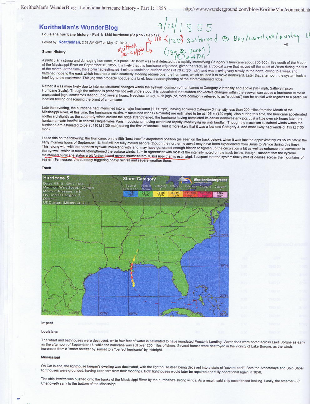
I base this on the following: the hurricane, on the fifth "best track" extrapolated position (as seen on the track below), when it was located approximately 28.8N 89.5W in the early morning hours of September 16, had still not fully moved ashore (though the northern eyewall may have been experienced from Buras to Venice during this time). This, along with with the northern eyewall interacting with land, may have generated enough friction to tighten up the circulation a bit as well as enhance the convection in the eyewall, which in turned strengthened the surface winds. I am in agreement with most of the intensity noted on the track below, though I suspect that the cyclone maintained hurricane status a bit f^rthor inland arrnss southeastern Mississippi than is estimated. I suspect that the system finally met its demise across the mountains of eastern Tennessee, undoubtedly triggering heavy rainfall and severe weather there.
Track
Impact
Louisiana
The wharf and bathhouses were destroyed, while four feet of water is estimated to have inundated Proctor's Landing. Water rises were noted across Lake Borgne as early as the afternoon of September 15, while the hurricane was still over 200 miles offshore. Several homes were destroyed in the vicinity of Lake Borgne, as the winds increased from a "smart breeze” by sunset to a "perfect hurricane" by midnight
Mississippi
On Cat Island, the lighthouse keeper's dwelling was decimated, with the lighthouse itself being decayed into a state of "severe peril”. Both the Atchafalaya and Ship Shoal lighthouses were grounded, having been tom from their moorings. Both lighthouses would later be repaired and fully operational again in 1856.
The ship Venice was pushed onto the banks of the Mississippi River by the hurricane's strong winds. As a result, said ship experienced leaking. Lastly, the steamer J.S. Chenoweth sank to the bottom of the Mississippi.

Historic Hurricanes (Treutel Book) Historic-Hurricanes-Of-Hancock-County-1812-2012-(014)