
This text was obtained via automated optical character recognition.
It has not been edited and may therefore contain several errors.
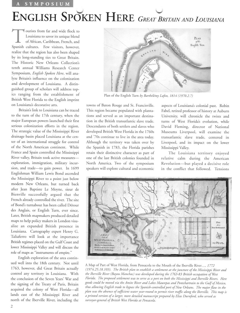
A SYMPOSIUM
English Spoken Here Great Britain and Louisiana
1*1.AN
'Pl?
EtioJHli Turn
Plan of the English Turn by Barthelemy Lafon, 1814 (1970.2.7)
Tourists from far and wide flock to Louisiana to savor its unique blend of African, Caribbean, French, and Spanish cultures. Few visitors, however, realize that the region has also been shaped by its long-standing ties to Great Britain. The Historic New Orleans Collection?s tenth annual Williams Research Center Symposium, English Spoken Here, will analyze Britain?s influence on the colonization and development of Louisiana. A distinguished group of scholars will address topics ranging from the establishment of British West Florida to the English imprint on Louisiana?s decorative arts.
Britain?s link to Louisiana can be traced to the turn of the 17th century, when the major European powers launched their first serious colonization efforts in the region. The strategic value of the Mississippi River drainage basin placed Louisiana at the center of an international struggle for control of the North American continent. While France and Spain controlled the Mississippi River valley, Britain took active measures? exploration, immigration, military incursion, and trade?to gain power. In 1699 Englishman William Lewis Bond ascended the Mississippi River to a point just below modern New Orleans, but turned back after Jean Baptiste Le Moyne, sieur de Bienville successfully argued that the French already controlled the river. The site of Bond?s turnabout has been called Detour des Anglais, or English Turn, ever since. Later, British mapmakers produced detailed maps to help policy makers in London visualize an expanded British presence in Louisiana. Cartography expert Henry G. Taliaferro will look at the importance British regimes placed on the Gulf Coast and lower Mississippi Valley and will discuss the role of maps as ?instruments of empire.?
English exploration of the area continued well into the 18th century. Not until 1763, however, did Great Britain actually control any territory in Louisiana. With the conclusion of the Seven Years? War and the signing of the Treaty of Paris, Britain acquired the colony of West Florida?all lands east of the Mississippi River and north of the Iberville River, including the
2
towns of Baton Rouge and St. Francisville. This region became populated with plantations and served as an important destination in the British transatlantic slave trade. Descendants of both settlers and slaves who developed British West Florida in the 1760s and ?70s continue to live in the area today. Although the territory was taken over by the Spanish in 1783, the Florida parishes retain their distinctive character as part of one of the last British colonies founded in North America. Two of the symposium speakers will explore cultural and economic
aspects of Louisiana?s colonial past. Robin Fabel, retired professor of history at Auburn University, will chronicle the twists and turns of West Florida?s evolution, while David Fleming, director of National Museums Liverpool, will examine the transatlantic slave trade, centered in Liverpool, and its impact on the lower Mississippi Valley.
The Louisiana territory enjoyed relative calm during the American Revolution?but played a decisive role in the conflict that followed. Tensions
A Map of Part of West Florida, from Pensacola to the Mouth of the Iberville River..., 1772 (1974.25.18.103). The British plan to establish a settlement at the juncture of the Mississippi River and the Iberville River (Bayou Manchac) was developed during the 1763-83 British occupation of West Florida. The proposed settlement was to serve as a port on both the Mississippi and Iberville Rivers. Here goods could be moved via the Amite River and Lakes Maurepas and Pontchartrain to the Gulf of Mexico, thus allowing English trade to bypass the Spanish-controlled port of New Orleans. The major flaw in the plan was the absence of sufficient water year-round to permit river traffic along the Iberville. This map is a printed version of a larger, more detailed manuscript prepared by Elias Durnford, who served as surveyor-general of British West Florida at Pensacola.
Battle of 1814 Here