
This text was obtained via automated optical character recognition.
It has not been edited and may therefore contain several errors.
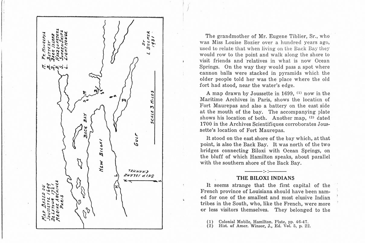
The grandmother of Mr. Eugene Tiblier, Sr., who was Miss Louise Bozier over a hundred years ago, used to relate that when living on the Back Bay they would row to the point and walk along the shore to visit friends and relatives in what is now Ocean Springs. On the way they would pass a spot where cannon balls were stacked in pyramids which the older people told her was the place where the old fort had stood, near the water’s edge.
A map drawn by Joussette in 1699, (1) now in the Maritime Archives in Paris, shows the location of Fort Maurepas and also a battery on the east side at the mouth of the bay. The accompanying plate shows his location of both. Another map, (2) dated
1700	in the Archives Scientifiques corroborates Jous-sette’s location of Fort Maurepas,
It stood on the east shore of the bay which, at that point, is also the Back Bay. It was north of the two bridges connecting Biloxi with Ocean Springs, on the bluff of which Hamilton speaks, about parallel with the southern shore of the Back Bay.
THE BILOXI INDIANS
It seems strange that the first capital of the French province of Louisiana should have been named for one of the smallest and most elusive Indian tribes in the South, who, like the French, were more or less visitors themselves. They belonged to the
(1) Colonial Mobile, Hamilton. Plate, pp. 46-47.
(2) Hist, of Amer. Winsor, J., Ed. Vol. 5, p. 22.
Biloxi Historical-Sketch---Bremer-(11)